Home Page Storm Chasing Storm Chase Info for Eastern Kansas Favorite Links
Central US Radar Click Maps Kansas Radars May 29-30, 1879 Tornadoes
|
Home Page Storm Chasing Storm Chase Info for Eastern Kansas Favorite Links Central US Radar Click Maps Kansas Radars May 29-30, 1879 Tornadoes |
|
June 8, 1998 Storm Chase(Culver, Kansas Tornado)Robert J. Herman A progressive outbreak of severe weather occurred during the afternoon and evening of June 8, 1998 and early morning hours of June 9, 1998. The first tornado touched down at 16:37 CDT (15:37 CST) 2 miles SE of Buhler, Kansas and the last at 00:01 CDT, June 9,1998 (23:01 CST, June 8, 1998), 2 miles NW of Midland, Arkansas. During the 7 hour 24 minute outbreak 25 tornadoes were reported, 18 - F0, 3 - F1 and 4 - F2.
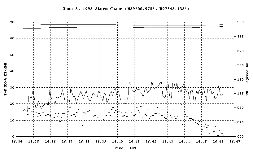
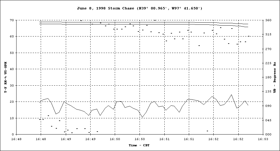
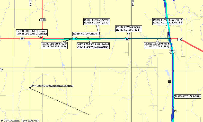
Parked 1.62 miles E of the intersection of K18/K106 on south side of K18. At this location the Culver tornado was observed. The wind continues to back at this location from northeast to west-southwest.
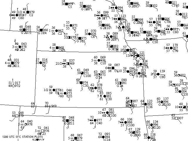
Surface map for 7 AM CDT, June 8, 1998.
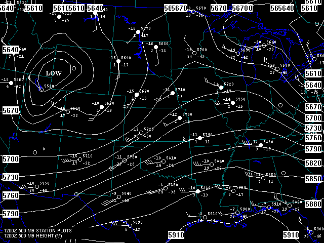
500 Mb Chart for 7 AM CDT
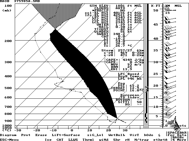
Modified sounding for 37° 30'N, 98° 30'W.
Mesoscale analysis 15Z (10 AM CDT June 8, 1998). Unfortunately I can't take credit for this complicated analysis and I don't know the name of the person who made it. Locating the outflow boundaries over Eastern Oklahoma was aided by local storm reports. At the location marked with a circled numeral 1 wind damage was reported at 1215Z and at location number 2 a 52 Knot wind gust occurred at 1355Z.
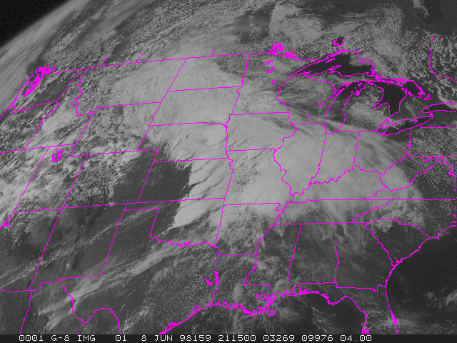
Visible satellite picture 1615 CDT. "Stinger's" can be seen on the SW end of individual supercells.
|
Contact InformationElectronic mail address Last revised: May 21, 2006 |